
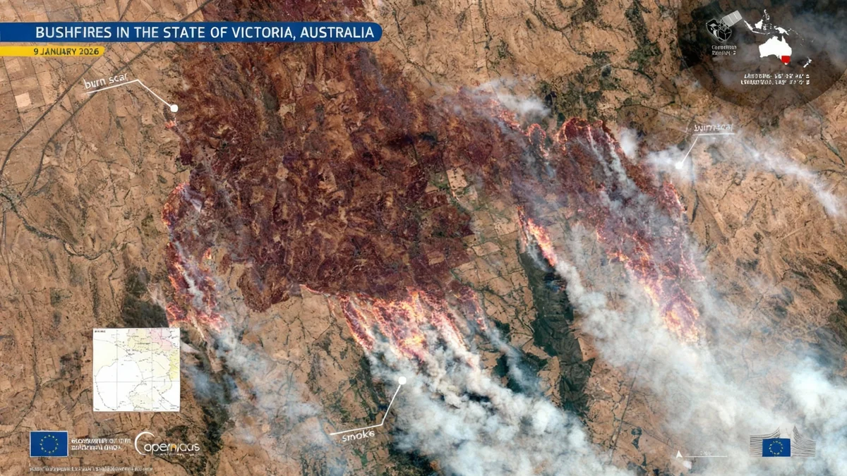
An advanced European satellite has captured startling images of the uncontrolled bushfires currently sweeping through northern Victoria, Australia. The imagery, recorded on January 9, 2026, reveals extensive burn scars across the landscape, providing critical data for emergency responders on the ground.
The fires have prompted widespread disruption, leading to the closure of hundreds of schools and forcing the evacuation of entire communities. Thousands of residents in the state of Victoria are currently without electricity as the disaster continues to unfold.
Key Takeaways
- European Copernicus Sentinel-2 satellites are monitoring the bushfires in Victoria, Australia.
- An image from January 9, 2026, shows large burn scars south of the town of Longwood.
- The fires have caused school closures, community evacuations, and power outages for thousands.
- The satellite uses advanced imaging technology to see beyond visible light, helping to assess vegetation damage and plan recovery efforts.
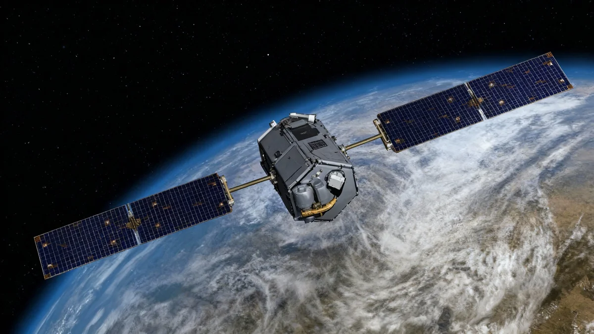
A View From Above
From low Earth orbit, the scale of the environmental crisis in Australia becomes clear. The Copernicus Sentinel-2 satellite, part of a European Earth-observation program, provided a detailed view of the situation south of Longwood, a town in northern Victoria. The image does not show flames but rather their aftermath: vast, dark patches of charred earth where the fire has already passed.
This orbital perspective is crucial for understanding the full scope of such events, which can be difficult to assess from the ground, especially in remote or inaccessible areas. By capturing a wide-angle view, authorities can grasp the fire's perimeter and its movement across the landscape.
What is the Copernicus Program?
The Copernicus program is Europe's Earth observation initiative, designed to provide accurate, timely, and easily accessible information to improve environmental management and understand the effects of climate change. It utilizes a family of satellites known as Sentinels to monitor land, oceans, and the atmosphere.
The Technology Behind the Images
The Sentinel-2 satellites are equipped with more than just a standard camera. They carry a high-resolution instrument that records light in 13 different spectral bands. While some of these bands capture visible light, others detect near-infrared and short-wave infrared wavelengths, which are invisible to the human eye.
This advanced capability is particularly useful for monitoring events like wildfires. Infrared bands can effectively measure the health of vegetation, detect moisture levels in the soil, and clearly distinguish between burned ground and untouched areas. This technology allows analysts to create highly accurate maps of the damage.
Differentiating Smoke from Scars
One of the key challenges in monitoring fires from space is distinguishing between different elements on the ground. The multi-spectral imager on Sentinel-2 helps overcome this.
- Smoke vs. Clouds: The satellite's sensors can differentiate smoke plumes from cloud cover, ensuring a clearer view of the ground.
- Burn Scars vs. Soil: It can also tell the difference between charred land and bare soil, which might look similar in a normal photograph.
- Vegetation Health: By analyzing how vegetation reflects infrared light, scientists can assess the severity of the fire's impact on forests and grasslands.
The Sentinel-2 mission consists of a pair of identical satellites orbiting 180 degrees apart, allowing them to revisit and image the same spot on Earth every five days at the equator.
Supporting Emergency Response
The data collected by satellites like Sentinel-2 is not just for observation; it plays a direct role in managing the crisis. Emergency response teams use this information for several critical tasks.
First, the imagery helps in mapping the boundaries of the burned area. This allows officials to understand how much land has been affected and where resources need to be deployed. As new images arrive, these maps are updated, providing a near-real-time view of the fire's progression.
Second, the data is used for damage assessment. By analyzing the severity of the burns, authorities can begin to estimate the impact on infrastructure, agriculture, and natural habitats. This information is vital for coordinating relief efforts and directing aid to the hardest-hit communities.
"This type of satellite imagery is indispensable for emergency response and long-term recovery planning. It provides a clear, unbiased picture of the situation on the ground that is essential for making informed decisions."
Planning for Recovery and the Future
The work of the Sentinel-2 satellites continues long after the flames are extinguished. The recovery of a landscape ravaged by fire is a long and complex process, and continuous monitoring from space is a key part of it.
After a fire, the land is vulnerable. The loss of vegetation can lead to soil erosion, which in turn can pollute waterways and damage aquatic ecosystems. Recovery teams must work to stabilize the soil and protect these vital water sources. Satellite data helps identify the areas most at risk, allowing for targeted intervention.
Tracking Nature's Regeneration
The repeated scans from the Sentinel-2 mission also allow scientists and environmental managers to track the long-term recovery of the ecosystem. By comparing images taken over months and years, they can monitor how and where vegetation begins to grow back.
This long-term data helps answer important questions about how different types of forests and grasslands regenerate after a fire. It provides invaluable insight into the resilience of nature and informs future land management strategies designed to mitigate the risk and impact of bushfires.