

A recent investigation reveals the United Kingdom is among the top five European countries for the highest rate of green space loss relative to its size. Between 2018 and 2023, an area of natural land and farmland equivalent to the New Forest was converted for development, raising concerns about the effectiveness of land protection policies.
Key Takeaways
- The UK lost 604 square kilometers of natural and agricultural land to development from 2018 to 2023.
- The country ranks fifth-worst in Europe for the proportion of green space lost compared to its geographic size.
- Within the same period, 12 square kilometers of specially protected national landscapes were developed, an area equal to 1,680 football pitches.
- Major projects like HS2 and numerous housing developments are significant contributors to this land conversion.
Scale of Land Conversion in the UK
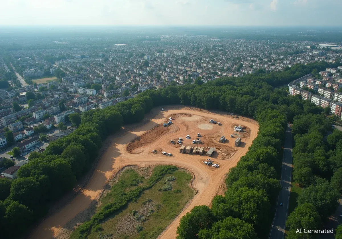
A cross-border analysis using satellite imagery has quantified the significant conversion of green space to developed land across the UK. The study, conducted by European media partners and the Norwegian Institute for Nature Research (Nina), found that 604 square kilometers of natural and agricultural land were lost over a five-year period.
This extensive loss highlights a growing tension between the need for new housing and infrastructure and the preservation of the country's natural capital. The research employed a supervised machine learning model to analyze land use changes, providing a detailed picture of development patterns.
Europe's Shrinking Green Space
The investigation estimated that across Europe, natural areas equivalent in size to the entire country of Cyprus were lost to development during the same 2018-2023 period. This equates to a daily loss of approximately 600 football pitches of nature and crop land.
Impact on Protected National Landscapes
The data shows that even areas with the highest levels of protection are not immune to development. In England, Wales, and Northern Ireland, areas formerly known as Areas of Outstanding Natural Beauty (AONB) and now called national landscapes have seen significant encroachment.
Over five years, 12 square kilometers of these protected zones were developed. This includes nearly 250 large-scale projects, each covering more than 10,000 square meters. These developments occurred despite regulations designed to restrict construction in such sensitive environments.
What Are National Landscapes?
National landscapes are designated areas of countryside in England, Wales, and Northern Ireland that are protected for their significant landscape value. The primary purpose of this designation is to conserve and enhance their natural beauty, making development within them subject to strict planning controls.
Key Areas Affected by Development
The investigation identified seven national landscapes where the majority of large developments took place. These areas are known for their scenic beauty and ecological importance.
- The Cotswolds
- The Chilterns
- High Weald
- North Wessex Downs
- Kent Downs
- Dorset
- The Shropshire Hills
While some projects were minor, such as barn conversions or road widening, many were substantial housing and infrastructure projects that permanently altered the landscape.
Drivers of Green Space Loss
Both national infrastructure projects and local housing demand are driving the conversion of green fields. The analysis identified a range of development types that are encroaching on natural and protected areas.
HS2 and Other Infrastructure
The controversial High Speed 2 (HS2) rail line is one of the most visible examples of a major infrastructure project impacting a protected area. Satellite imagery clearly shows the construction corridor cutting directly through the Chilterns national landscape in Buckinghamshire.
Widespread Housing Projects
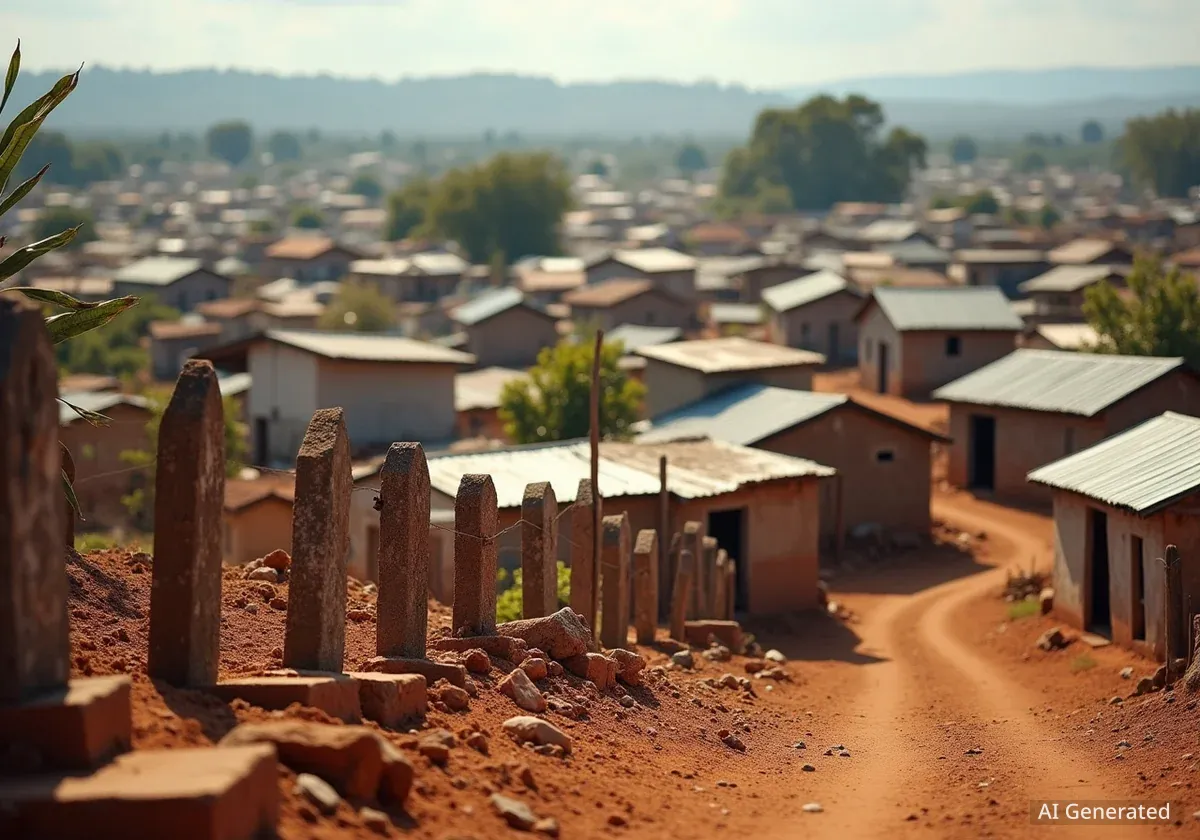
Beyond large-scale infrastructure, the primary driver of land conversion is residential development. The analysis highlighted several large housing estates built on former green fields within national landscapes, including:
- The northward expansion of Poundbury in Dorset.
- The Lancaster Park development near Hungerford, Berkshire.
- A new housing development northeast of Fownhope in Hereford.
These projects represent a pattern of suburban expansion into areas previously designated for conservation.
Expert Reaction and Alternative Solutions
Conservation groups have expressed alarm over the findings, arguing that the loss of green space is unnecessary given the availability of alternative sites for development. Roger Mortlock, chief executive of the countryside charity CPRE, criticized the current approach to land use.
"For a small island we are still struggling with the idea that land is finite. It’s shameful to be so near the top of this list when the countryside in this country is so valued... It is also so unnecessary when brownfield land, even with planning permission, remains unused."
Mortlock advocated for a shift in strategy, urging a focus on creating "compact sustainable places that celebrate the countryside on their doorstep" instead of building "land-hungry, car-dependent, identikit, unaffordable housing estates."
The Brownfield Alternative
According to recent research, England has enough previously developed land, known as brownfield sites, to accommodate nearly all of the 1.5 million new homes the government aims to build by the end of the current parliament. Prioritizing these sites could significantly reduce pressure on green fields.
Concerns have also been raised about future legislation. A new government planning bill, currently progressing through parliament, could potentially weaken protections for around 5,000 of England's most protected natural areas. Observers suggest the bill might allow developers to bypass certain environmental rules by contributing to a central fund, a move critics see as a regression in environmental law.